Havana map poster
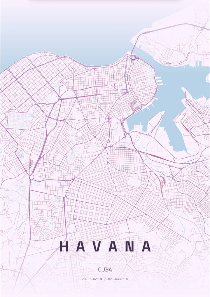
The Malecón runs along the northern shore, with the harbour inlet beside the old town and a loose grid inland.
- Theme: Pastel Dream, or pick from 50+ others
- Print sizes up to 100 cm with a live DPI readout
- PNG, print-ready PDF and layered SVG export
- Change the text, map layers and markers
- Pastel Dream theme: palette and example posters
About the Havana map poster
Havana, Cuba, has a map that is split by the sea and the harbour. The Malecon is a long seafront wall that curves along the northern coast, while the harbour inlet opens in a narrow mouth guarded by the Morro and La Cabana fortresses on one side and the old city on the other. Old Havana is a dense mesh of narrow lanes around the plazas, the Capitolio stands at the edge of a wider grid, and the Prado runs as a straight promenade to the water. West of the centre the Vedado neighbourhood has a regular grid, and Revolution Square and the Almendares River lead into Miramar further out.
How to make your Havana poster
- Open the Havana design: the map is already centred on the city in the Pastel Dream theme.
- Change the theme, title and text, switch map layers on or off, and add your own markers.
- Pick a paper size and export a PNG, a print-ready PDF or a layered SVG.
Print sizes and file formats
Export sizes go up to 100 cm, with a live DPI readout so you can check the resolution before printing. The map is drawn from OpenStreetMap data, so every street, park and shoreline is the real layout of Havana.
Frequently asked questions
- Can I change the text on the Havana poster?
- Yes. The title, subtitle and coordinates line are all editable, so the poster can show Havana, a neighbourhood or a personal message.
- Which theme does the Havana example use?
- The Pastel Dream theme. It is only a starting point: any theme can be applied, and colours can be adjusted.
- Can I make a poster of another place in Cuba?
- Yes. Search any city, address or landmark in the editor and the map recentres there.
More city map posters
- London
- Istanbul
- Berlin
- Paris
- New York
- Tokyo
- Rome
- Barcelona
- Amsterdam
- Vienna
- Prague
- Lisbon
- Madrid
- Moscow
- Dubai
- Mumbai
- Singapore
- Sydney
- San Francisco
- Chicago
- Rio de Janeiro
- Buenos Aires
- Cairo
- Seoul
- Mexico City
- Hamburg
- Izmir
- Venice
- Copenhagen
- Stockholm
- Athens
- Budapest
- Cape Town
- Hong Kong
- Vancouver
- Kyoto
- Edinburgh
- Florence
- Dublin
- Oslo
- Helsinki
- Lyon
- Naples
- Bangkok
- Shanghai
- Toronto
- Washington, D.C.
- Reykjavik
- Porto
- Kuala Lumpur
- Munich
- Brussels
- Milan
- Zurich
- Geneva
- Warsaw
- Krakow
- Marrakech
- Abu Dhabi
- Delhi
- Taipei
- Beijing
- Osaka
- Hanoi
- Ho Chi Minh City
- Melbourne
- Auckland
- Lima
- Bogota
- Santiago
- Montreal
- Boston
- Los Angeles
- Seattle
- Miami
- Tallinn
- Valencia
- Seville
- Frankfurt
- Cologne
- Rotterdam
- Bucharest
- Belgrade
- Tbilisi
- Doha
- Baku
- Kolkata
- Jakarta
- Manila
- Busan
- Hiroshima
- Perth
- Wellington
- Brisbane
- Montevideo
- Philadelphia
- New Orleans
- San Diego
- Valletta
All city posters · Open the poster editor · How to make a map poster