Warsaw map poster
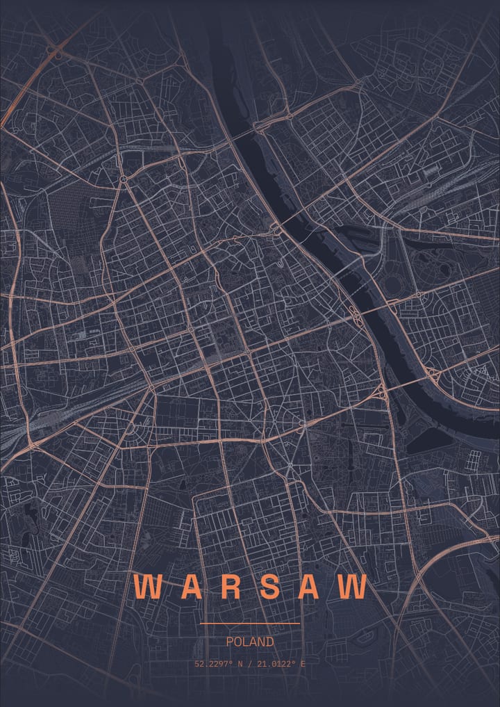
The Vistula runs along the east side of the centre, with the rebuilt Old Town on the western bank near the river.
- Theme: Slate Ember, or pick from 50+ others
- Print sizes up to 100 cm with a live DPI readout
- PNG, print-ready PDF and layered SVG export
- Change the text, map layers and markers
- Slate Ember theme: palette and example posters
About the Warsaw map poster
Warsaw, Poland, sits on the wide, slow Vistula, and the river's sandbanks and green embankments give the east side of the map a loose, natural edge. Across the water, the Praga district spreads out with its own park and zoo. On the western bank the reconstructed Old Town sits next to the Royal Castle, and the Royal Route runs south from there along a ridge through Krakowskie Przedmiescie and Nowy Swiat. The Saxon Garden and Lazienki Park supply green patches, and the Palace of Culture and Science stands out in a gridded downtown.
How to make your Warsaw poster
- Open the Warsaw design: the map is already centred on the city in the Slate Ember theme.
- Change the theme, title and text, switch map layers on or off, and add your own markers.
- Pick a paper size and export a PNG, a print-ready PDF or a layered SVG.
Print sizes and file formats
Export sizes go up to 100 cm, with a live DPI readout so you can check the resolution before printing. The map is drawn from OpenStreetMap data, so every street, park and shoreline is the real layout of Warsaw.
Frequently asked questions
- Can I change the text on the Warsaw poster?
- Yes. The title, subtitle and coordinates line are all editable, so the poster can show Warsaw, a neighbourhood or a personal message.
- Which theme does the Warsaw example use?
- The Slate Ember theme. It is only a starting point: any theme can be applied, and colours can be adjusted.
- Can I make a poster of another place in Poland?
- Yes. Search any city, address or landmark in the editor and the map recentres there.
More map posters of Poland
More city map posters
- London
- Istanbul
- Berlin
- Paris
- New York
- Tokyo
- Rome
- Barcelona
- Amsterdam
- Vienna
- Prague
- Lisbon
- Madrid
- Moscow
- Dubai
- Mumbai
- Singapore
- Sydney
- San Francisco
- Chicago
- Rio de Janeiro
- Buenos Aires
- Cairo
- Seoul
- Mexico City
- Hamburg
- Izmir
- Venice
- Copenhagen
- Stockholm
- Athens
- Budapest
- Cape Town
- Hong Kong
- Vancouver
- Kyoto
- Edinburgh
- Florence
- Dublin
- Oslo
- Helsinki
- Lyon
- Naples
- Bangkok
- Shanghai
- Toronto
- Washington, D.C.
- Reykjavik
- Porto
- Kuala Lumpur
- Munich
- Brussels
- Milan
- Zurich
- Geneva
- Krakow
- Marrakech
- Abu Dhabi
- Delhi
- Taipei
- Beijing
- Osaka
- Hanoi
- Ho Chi Minh City
- Melbourne
- Auckland
- Lima
- Bogota
- Santiago
- Montreal
- Boston
- Los Angeles
- Seattle
- Miami
- Tallinn
- Valencia
- Seville
- Frankfurt
- Cologne
- Rotterdam
- Bucharest
- Belgrade
- Tbilisi
- Doha
- Baku
- Kolkata
- Jakarta
- Manila
- Busan
- Hiroshima
- Perth
- Wellington
- Brisbane
- Havana
- Montevideo
- Philadelphia
- New Orleans
- San Diego
- Valletta
All city posters · Open the poster editor · How to make a map poster